Friday, June 13, 2014

Experiment in Logistics -- June 2014


For our second hike of 2014 (all have to catch up on other hikes soon), we decided to experiment with a concept I called "leapfrogging," for lack of a term that I knew.  The plan was to slackpack between cars, with our camping gear in the cars, driving around to hike the next day back to the first car.  That was the plan, and in theory, it is doable.

So the plan was that Rhino and I would drive down Friday morning, hike 8 miles.  Our sister Princess (trail-name still in flux) -- joining us for the second time -- would pick us up, we would stay at a place in Blacksburg, hike about 17 miles the second day, camp out, and hike about 11 miles on the last day.  I figured that slackpacking, we should be able to manage that.

That was the plan.

Then reality hit.

Day 1
Rhino and I got a little bit of a late start, but was able to hit the trail about 3:30 on Friday.  We started out on 601, which turned out to be pretty rough with some deep ruts from erosion.  As we were getting ready to begin, several individual through hikers came past, including CropDust who chatted with us for a while.  As we began, we kept an eye out for a camping spot within a reasonable distance from the car for the second night, but there was nothing for while over half a mile.  We did run through some stinging nettles, and that provided some distraction.

The highlight of the day was the sunset, where we met a German couple, who I'll call Hansel & Gretel.


We got to Princess around 8:45 on Route 613, just as it was getting dark.

The hotel we booked on Hotwire.com turned out to be The Inn at Virginia Tech.  We got checked in, and proceeded to PK's, which we understood had pizza, something Rhino had been craving for the last few miles of the hike.  The rest of the evening included darts, tequila, and pitchers of beer, but not in that order.

Day 2
The next morning began much later than expected, and included a much needed awful waffle from the local Waffle House.  Instead of the 17 miles that had been planned, we looked for the next road up the trail from my car and that turned out to be Route 42, about 6 miles worth of hiking.  There was no crossroad between the 6 miles and the 17 miles.  To be honest, the wine festival at VT looked much more appealing, but we maintained some dignity and headed out to the trail.

All in all, it was a good hike, and felt like much more than 6 miles, primarily due to a nearly 2,000 foot climb. We started out in a meadow, but a nearby beaver dam made the meadow into a swamp, so we started out with wet feet.  Some Three Brothers Great Outdoors provided for a nice afternoon pick-me-up after we let it chill in the mountain stream we stopped at to refill water.  (Oh, did I mention I left my water bottle at the hotel?  I brought beer, but forgot water.  Shows my priorities.)


Some rocks provided for a nice overlook as some ominous, but dry, clouds rolled around the area.


As we reduced the distance to my car, we were already beginning to think that we might not camp out.  Perhaps Princess had no intention of camping, but she maintained the ruse for a little longer.  The descent down to my car was relatively steep (and we passed several through hikers trudging their way up that hill).  Halfway down the hill, Princess declared firmly, "I am not climbing back up this hill to camp."

We agreed that we would head back to civilization in Blacksburg, got Princess's car, and managed to book another night at The Inn on Hotwire, where I joyously recovered my water bottle.  Our tummies were satiated at Cabo Fish Taco, where Princess noted, "I've been to the one in Charlotte.  I didn't know this was a chain!"  Turns out they have only two locations:  Charlotte and Blacksburg.

Day 3
We bid a fond farewell to The Inn and breakfasted at Hardees.  Rhino & Princess each stashed away a chicken biscuit for their afternoon pick-me-up.  We decided to continue from where we left off last year at the Dragon's Tooth parking area, so we dropped my car off at 620, the first road South of Dragon's Tooth.  The drive from there to the parking area turned Princess's Nissan into a ford.


The climb up to Dragon's Tooth proved to be quite a challenge, not at all overrated.  Princess managed to catch herself on her chin at one point.


My two compatriots stayed on the ground around the Tooth, but the view was spectacular.


The trek down the other side towards 620 was rather uneventful, except for one moment where Rhino was truly airborne for several seconds.  Hint: it involved a rather large black snake.


By my car, we chatted with a hiker for a while who was trying to meet up with some nearby friends, but had lost contact with them.  After a while, another hiker, Hamster, joined us, and we provided him with some food we had with us and in my car to ease his food anxiety.  We all drank a beer together.  Cheers!

Friday, April 27, 2012

Invading Pennsylvania

It has been way too long since we have posted, but contrary to popular belief, we are not dead.

We had a nice 37 mile hike south of the James River in central Virginia in May 2011.  I will have to provide an update on that one later, in addition to the last day hike in Maryland, which had its moments.

Tomorrow, Rhino and Bullfrog and our other brother, Skeet, will begin into Pennsylvania, taking on about 30 miles over 3 days.  We will provide a post and picture when we get back -- if we get back.

Sunday, October 17, 2010

By the Numbers: Status to Date

2: Sections of the trail that we've completed (Northern Virginia/Maryland and Shenandoah National Park)
4: States in which we've hiked (Virginia, West Virginia, Maryland, and Pennsylvania [so it's a 1/10 of a mile?])
4: Dayhikes it took to complete Maryland
5: Years that we've been doing this
7: Maps that we've completed (Maryland, 2 Northern Virginia, 3 Shenandoah National Park, 1 Central Virginia)
12.8: Percentage of the entire trail that we've completed
234: Miles that we've hiked in Virginia
279: Total miles that we've hiked -- From the Mason-Dixon Line to the James River
316: Miles left in Virginia
1900: Miles remaining of the entire Trail
2,179: The entire AT, our one goal

Wednesday, March 24, 2010

On to the James River

On July 24-26, 2009, Rhino & Bullfrog continued their journey south on the AT, picking up from where they left off in August 2008 at Hog Camp Gap. But just getting there was a chore as we began to fully be impressed by how far south we have hiked in total.

After meeting up at Gander Mt. for some last minute supplies, we hopped on 81 South, settling in for a couple of hours. We were glad that the traffic in the Northbound lanes was not in our -- or that we were not bound for the north -- as that traffic was stopped or slowed for some 40 miles as the result of three separate accidents. Nevertheless, before our exit, I was beginning to worry about my car which is really showing the signs of its age ... and that little leak in the radiator. Oh, and the CV joints badly in need of replacing.

After stopping in Lexington for some grub and some replenishment of my precious automobile fluids, we headed back over the Interstate and away from cell phone coverage. Passing through Buena Vista, we went past Glasgow and followed the James River east and found the AT footbridge and parked my poor little car there. I hopped into the successor to Gray Ghost and we went back through Buena Vista before heading back to east again into the wilderness and up the Forest Service road that is the only means to Hog Camp Gap.

As we picked up our third leg of the Central Virginia section of the AT, we weren't sure how many hikers we'd see on this trip. Not only was it a miserably hot time of the year, it was too late in the season to see Sobo through hikers. Plus, any Nobo hikers would be way too late to have an honest chance of making it to Mt. Katahdin before it was life-threatening. Nonetheless, the first hiker we came upon, about an hour and a half into our hike turned out to be just that, a Northbound purportedly through-hiker. Yet, it was apparent that this hiker knew that he was done. Never was defeat so palpable to me in the body language (of an adult) than this hiker, who was sitting with his pack off, leaning against a rock. It looked like he had given up even on death. I didn't know how crazy he was, so we didn't dally long by him, but wished him luck and continued on our way.

We had a good, hot time; climbed some nice hills; went around the Lynchburg Reservoir; discovered the remains of a lost civilization, a sort-of self-sufficient commune that was tucked up in a valley, and provided a haven for newly-freed slaves at the end of the 19th Century. We crossed more of these little wooden foot bridges than ever before, by the time we got to the James River. We were exhausted but triumphant once again, and relaxed a little soaking our feet in the River before we headed back to civilization. Another 27.5 miles under our belts. But some of those mountains south of the James looked rather menacing.

Thursday, July 23, 2009

Bullfrog: Back to the Trail to the South

Tomorrow, we're picking back up where we left off last August. Hopefully, we'll make it to the James River. We might be having a guest join us; stay tuned.

Bullfrog: A hike without Rhino...

is like a day without sunshine.

Seriously, Rhino had to be out of town and two other guests bailed on me. So, Robert and I went instead on June 19-21. We hiked from Snicker's Gap (Route 7, Bear's Den) to Chester Gap (Route 522) just southeast of Front Royal. It was the same section Rhino and I had done in hikes #2 and 3. Rob and I did about 11 miles the first day, about 17 miles the second day, and coasted to my car on Sunday around 11 am with about 6 miles for a grand total of a little over 34 miles. Not bad. Then I went to the farm and fished all afternoon and got a sunburn on my legs.

Highlights:
  • It rained Saturday morning, but then cleared up. Not nearly as much water through there as Hike #3.
  • Sunday was Father's Day and also the First Day of Summer, also known on the AT as Naked Hiking Day. We saw only one naked hiker, a dude with bandana strategically placed on the waist-strap of his backpack, so we didn't see any of his junk.
  • We camped at the top of the hill just south of I-66. There was a wonderful meadow at the top ... laced with poison ivy.

Sunday, March 29, 2009

Who says the Washington Post has nothin' good!

Here is a good article about thru-hiking the AT. Someday, someday.

Thursday, March 19, 2009

First Hike of 2009


Bullfrog and I drove up to Maryland again for a quick day hike north along the AT. We had started in Gathland State Park last year and this is were we picked the trail up again. Since it was only going to be a quick day hike I didn't want to overpack...but I did. God! It felt good to get out and on the trail again. Bullfrog and I hadn't seen each other in months, and as we talked, and walked the miles seemed to fly by. My core temperature began to warm up and the jacket came off. We stopped at some Civil War monuments for a quick lunch of tuna and crackers.

While there we met another hiker who had been section hiking for 10 years from Georgia and had finally made it to Maryland. He was doing the Maryland Challenge, which is Hiking all of Maryland in one day...about 40 miles. We continued on just enjoying the day. I really didn't have any problems with fatigue or endurance and we just kept trucking on. At a clearing we looked back at the distance we had travelled, seeing landmarks on the horizon that we had passed early on that day. Around mile 10 we arrived at the Washington National Monument and it began to sleet/rain. The monument was interesting but the weather was beginning to suck and I was getting tired so we didn't hang out to long.


My pack was really digging into my shoulders by the time we reached the Interstate 70. As we victoriously crossed over the bridge, cars zooming underneath I raised my hiking poles in triumph. I got a few honks for my efforts. 12 miles a good day.

Monday, February 9, 2009

Duality

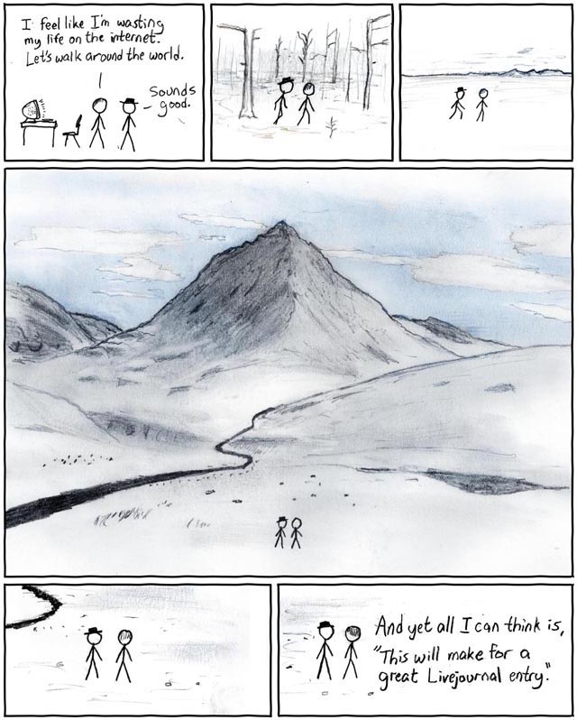
And no, I don't mean people fighting each other.


Courtesy of xkcd (http://xkcd.com/77/)

Thursday, December 11, 2008

Return of Self-Defense to National Parks

The AT running through several National Parks, as well as being part of the National Park system, it is of interest that the Department of the Interior has changed the regulations regarding the possession of concealed firearms in national park areas and national wildlife refuges.

Prior to the rule change, firearms were not permitted in national parks unless they were unloaded and locked in a trunk. This was inconsistent with regulations with respect to lands under the control of the U.S. Forest Service or the Bureau of Land Management, which, generally speaking, apply the respective law of the state in which the land lies. As of January 9, 2009, if you possess a valid concealed carry permit in Virginia, you will be able to legally carry a concealed firearm in National Parks in Virginia.

This change in NPS regulations was requested by 51 U.S. Senators from both parties. The Federal Register notice indicates that the Department of Interior received approximately 125,000 comments to the original proposed rule, much more than most notices of proposed rulemaking receive.

Although there are arguments against the change, many of them fail to reflect reality (e.g., federal law enforcement can provide adequate protection in the many square miles that people cover in the National Parks, or there will be an increase of criminal activity). The new rule provides a consistency within the individual states that allows those legally carrying a weapon for self defense to do so with some confidence.

Sunday, August 17, 2008

Bullfrog: Second Leg in Central Virginia

On August 9-10, 2008 Rhino and I headed back to the Trail after what felt like an extremely long two and a half months. Joining us were guest hikers Robert (from two previous hikes) and Jen.

We started at the Tye River and hiked south 19.5 miles. It was a long hike up "The Priest" from the River (about 3,000 ft. up over about 4 miles). On the way up we encounted an angry swarm of bees which managed to hit me once, and Rob and Jen a couple of times each. Rhino avoided having his tough hide breached by the stingers.

We ended at Hog Camp Gap where there was a nice meadow right before the Forest Service road where we parked.

Tuesday, June 17, 2008

Rhino: Hiking News

1. First the Oh Crap! News. They extended the Appalachian Trail all the way to Alabama connecting it with the famous Pinhoti National Recreation Trail.
Now we have to go to Alabama too.

2. Now the OMG News. UltraRunner Karl "Speedgoat" Meltzer is going to try and break the Speed record for the AT. His Goal 47 days 13 hours and 31 minutes. He will be traveling light with a support crew and sleeping in a bed every night...but I got to tip my hat. Thats gonna be rough. The cool thing is he will be wearing a GPS so we can track his progress on his web site.

karlmeltzer.com


3. Finally what will we do when we complete the Appalachian Trail, Pacific Crest Trail and the Continental Divide. Why the next big fad will be the North Country National Scenic Trail (NCT) This behemoth of a cross country trail will stretch all the way from New York to North Dakota...
Check it out here.

http://www.northcountrytrail.org/

Jeff "Rhino" Morgan

Friday, June 13, 2008

Good quote

Too often I would hear men boast of the miles covered that day, rarely of what they had seen. -Louis L'Amour, novelist (1908-1988)

Saturday, May 31, 2008

First Leg South of the Shenandoah National Park

Last weekend -- Memorial Day weekend -- Rhino and I continued our Southward journey on the AT. We picked up where we left off last September at Rockfish Gap, at the bottom of the Shenandoah National Park.

Our initial plan was to start Friday and finish sometime Monday. I took Friday off, but Rhino had an important meeting at his work that was specifically about Rhino ... so he had to be there. But he was able to take off early, and was on the road, heading West, by 1 pm.

Day 1

We met at Gander Mountain, on the South side of Winchester, and picked up a two-man tent, a nice, light Kelty that would be lighter than our individual tents. We then headed South to drop off one of the cars. After a slight detour (i.e., Bullfrog's failure to exit I-81 at the right place), with excellent input from Bullfrog's wife, we meandered down Route 56 until we got to Fish Hatchery Rd., just past Montebello, VA.

At that point, we stopped and I explained that if we went up Fish Hatchery Rd., we would have to hike about 38 miles, but if we continued down 56, we would have to hike "only" 30 miles. After a brief consultation, we decided to do the 30, and parked on 56, just across the road from Tye River.

We dropped off my car (shall I call it the Gray Goblin?), and I piled into the Gray Ghost. Looking at my trusty map, I directed Rhino to a shortcut (like 10 miles shorter) which took us on a gravel road up several switchbacks up a mountain. We finally made it to Rockfish Gap, where we unpacked the new Kelty tent, and repacked our packs with just the supplies we would need.

We hit the trail around 5 pm, hoping to get five miles to the base of Humpback Mountain before nightfall. We approached the Paul C. Wolfe shelter right around 8:30, found that it was full (not that we were disappointed, since we weren't planning on staying in it) and proceeded to find a site and set up our tent. After a Mountain House meal of beef stroganoff and a brief chat with a through-hiker camping near us, we settled down to a nice night. The ambient sound of the cascading stream near us made it difficult to hear random sounds of the night that make it difficult to focus on sleep.

Day 2

In the morning, we split a Mountain House granola and blueberries as we broke camp. We were on the trail around 8 am, and began to ascend the Humpback. We saw quite a few through-hikers heading North, sometimes stopping a few seconds to chat and sometimes just passing quickly. They started in Georgia in March, and while not all of them are going to make it to the end, they were all trail-experienced by this point.

We got to the top of Humpback and had a lunch of tuna and some trail mix and jerky. We continued and ended up stopping around 6 pm for the night atop a cliff (Ceder Cliff?) overlooking the Shenandoah Valley a couple thousand feet below us. We ate an old Mountain House beef stew. I watched over the last couple of hours of evening as a farmer below was round-baling a hay field. It was beautiful watching the sun set over the mountains to the West as the valley faded into dark and the various lights began to twinkle and take effect. Several bonfires were light around the valley just as it got dark. We didn't use our new tent, instead sleeping about 20 feet back from the cliff, with the AT between us and the edge.

We got 10 miles in that day, and although we had two days available ahead of us, were beginning to think about finishing the final 15 miles the next day.

Day 3

Sunday began for me as the eastern horizon began to show a bit of light (I could see Northeast, up the Valley). I didn't sleep again, and watched as the horizon brightened, the Valley began to awaken, and finally the sun peeked over the hills. I made some Mountain House eggs, into which I put some BBQ pork jerky for flavor/variety. We had Three Ridges to look forward to, only about a 1,500 climb (but over several miles). However, we still weren't sure how far we were going to go that day.

After crossing Bee Mountain, we began the ascent of Three Ridges, sometimes quite steep, some of the steepest climbs we've had the whole time. The actual peak had no views as it was covered with mature trees. Rhino took a quick nap at the top, and I wandered around and did find a rock with some ok views of the valley to the east.

The descent from Three Ridges down to Tye River was 3,000 feet over about 6 miles. As we descended, we were running out of water, and made refilling our main objective. Some of that descent was very steep, with lots of switchbacks. A through-hiker ascending Northward convinced us to go ahead and finish that day. It looked like we were going to have plenty of time, but would make the final decision once we got to Harper's Creek, where we would refill and have a place to camp if we wanted to. However, after refilling at the cold waters of Harpers Creek, we decided to sally forth and finish, pick up the Gray Ghost and head into Waynesboro to the A&W for some burgers.

We did finish and even made it to the Gray Ghost just as it was getting dark. Rhino wanted to get a room at a motel. We drove down into Waynesboro, but when we got to A&W, we found that their root beer tap was out of order ... and they didn't have any hamburger meat! So we ducked out of there, ate across the street, fueled up, and found that the motel was full (probably with through-hikers). We decided to head to our respective homes, and completed the weekend.

And yes, Rhino got poison ivy.

Friday, January 25, 2008

I've got a serious hankerin'


Bullfrog: I can't quite explain to you all of the feelings I've got seeing this picture right now ... other than I've got to hit the trail!!!!

Rhino: we did hit the trail in January but instead of traveling south we decided to do a day hike in Maryland. We started at Gathland State Park which was once the mountain home of George Alfred Townsend, a Civil War journalist. It is the site of a unique collection of buildings and structures that he designed and constructed, some of which have been restored. A large, stone monument dedicated to war correspondents is an outstanding attraction at this day use park. The park includes all of Crampton's Gap, which was the southern most gap fought over during the battle of South Mountain. Fought September 14, 1862, it was the first major battle of the Civil War fought in Maryland.

The picture is from the web. When we arrived early that morning, the weather was cold and there was thin layer of crunchy snow on top of the mountain. Jeremiah and I had packed light
since we wouldn't be staying overnight. We made some serious good mileage that morning as we hike the crest of the mountain. Eventually we arrived at the famous Weverton Cliffs. We both ate a power bar and rested on top of the cliffs. When we descended we joined the C&O Canal bicycling path for three miles of easy walking...but we were getting tired. Walking next to the Potomac we approached the Bridge into Harpers Ferry, where we stopped for an expensive burger and fries. Harpers Ferry was very nice and I would like to go back to visit someday. We stumbled to our cars finishing a blistering 15 miles in one day. Granted it was easy terrain with little mountain climbing but it was a very satisfying hike.

Thursday, September 20, 2007

Rhino: One Year Anniversary Hike!

It's hard to believe that its been one year since we started section hiking the Appalachian Trail. The adventure began friday night when after a long day at work, I decided to wait until Saturday morning to travel to the trail head. I was exhausted, and didn't feel like driving in traffic or sleeping in the car. The next morning I left the house about 0530 for the long drive to Waynesboro, VA. I had a lot on my mind and the 2.5 hour drive passed quickly. I met Jeremiah and Robert at the southern entrance to Shenandoah National Park, where I had to leave the Grey Ghost. We than began the 35mph drive up Skyline Drive to Doyles Run Overlook.

Doyles Run Overlook was right were we had left off last time with Jodi. We started out with high ambitions and a spring in our step. The weather was beautiful and we made great progress. One of the early highlights was our discovery of the Black Rock Bald. It was a huge boulder field on top of a Mountain. Jeremiah and I scrambled up for a spectacular 360 degree view. We hike a record breaking 14 miles that day. My only concern was by the time we found the perfect camping site we had not refilled our water bottles the whole day. I had anticipated numerous mountain springs...however there were none. Near the end of the day I started conserving water to just a sip, not my normal gulping refreshment. We had enough water to cook dinner. We set up camp, had dinner and bedded down for a chilly night. The temperature dropped to around 40 degrees F. I was pretty snug in my 1 man Eureka Tent. In the morning we were assaulted by a troupe of acorn throwing squirrels. They made such a racket, it sounded like it was raining acorns. Stiff and sore we broke camp and started on our final leg through Shenandoah National Park. We needed to hike 10 miles to my car.
The Amazing thing about this hike was how perfect it was...except for the water concerns, we had a beautiful hike. No Bugs, No rain, No injuries It was the perfect hike. We did find a spring in the morning and replenished our water supplies for the rest of the hike. We found a nice apple tree at Beagles Gap a mountain meadow were we took a thirty minute break.
Near the end of the trail we ran into a little trail magic. Some kind soul had left chocolate bars and a case of Mountain Dew near a tree with nice note encouraging hikers.

Side Note: No matter how much I try to avoid Poison Ivy...I can't...I tried, however I got it again.

Sunday, August 26, 2007

Rhino: Jodi and the 5 Mts of Misery

We had a special guest hiker with us on the seventh leg of the AT in the Shenandoah National Park, our sister Jodi drove up on Friday. We drove out to the trail head that evening and tried to sleep in our cars. Had a fun time catching up with Jodi and all her news from Charlotte, NC. I couldn't fall asleep in my car so I pulled my sleeping pad and sleeping bag out of the car and laid down on them. As I was gazing up at the brilliant Milky Way with a breeze blowing over me I witnessed a meteor shower, I saw three "shooting stars" Around 4am I dozed off. I was the first to wake around 063oam and watched the beautiful sun start to climb over the mountains to our east. I didn't know it, but I would be cursing the same sun hours later. We got our gear and piled into the Grey Ghost and drove 20 miles north to our starting point at Hightop Mountain about 1 mile north of rt 33.
Hightop Mountain nearly kicked my butt in the first hour, the Cliff Bar I had consumed so rapidly, was giving me cramps as we struggled up the mountain. Jodi thought I was taking it easy on her but I was really having some issues. When we reached the top and started looking at the elevation map, we realized there where four more mountains of considerable size with descent just as great. It reminded me of the roller coaster in Northern Virginia. Jodi stated she would like to get 15 miles done today, because she need to be home by 5pm on Sunday. I just laughed...I had never done 15 miles in a day and I knew she was being a little to optimistic.
We continued hiking and the day started heating up. We became soaked with sweat from our exertions and tried to keep hydrated by sipping our water at regular intervals. Our spirits were high as we joked and talked up trail. Jeremiah and I must have told Jodi every experience we had on the AT. She was really pushing it and seemed very motivated. But the terrain and heat would take it toll. When I came home on Sunday my wife claimed that we had hiked on the hottest day of the year 103 degrees F. We didn't know it at the time, all we knew was it was damn Hot! Jeremiah said it was the humidity that was killing us. I didn't argue...I was to tired.
Around mile 5 Jodi started complaining about a knee injury. Now I remember how I felt on my first hike so I was pretty concerned...We gave her some Icy Hot to put on her knee, and I put it on both my knees. Around noon we collapsed right on the trail and we each ate a power bar. It felt like heaven or hell I'm not sure. The bugs, flys, bees and gnats were relentless and soon forced us to continue. Jodi was limping more, and I began to think we should readjust our goals and get her off the trail ASAP to avoid furthering her injury...not to mention I didn't want to be out here in this blistering heat. We completed our third mountain and decided to refill at a Park ranger station 2oo yrds off the trail. We saw an amazing congregation of little butterflies, there must have been hundreds. The water from the Park Ranger station was cold and plentiful I poured a whole bottle over my head trying to cool off. Jodi went inside the ranger station to use the bathroom and came out with an ace bandage and an Ice pack that Ranger Rick had so graciously given her. She felt better and wanted to press on. I suggested to Jeremiah we should get to the next hut and call it a day.
As we were climbing the next mountain we began to hear ominous rumbling of thunder in the distance. We tried to pick the pace up but the never ending incline was absolutely kicking our butts. I began daydreaming about what we would find at the Hut maybe some day hikers with a cooler of cokes and beer...yeah. I began hallucinating and seeing things, like the hut and at one point I thought I could see a lake through the trees. Thats when I realized it was just the sky. We limped into the hut and found it was deserted except for the stench of mice or human urine. It was so revolting we had to set up our tents instead. The thunder seemed to be getting closer as Jeremiah heated up water for our trail dinner of sweet and sour pork with rice. I began having muscle cramps that would throw me to the ground writhing in pain. Jodi laughed and said I was a bigger mess than her...which was pretty close to the truth. Jeremiah and I had just finished our medicinal nightcap, when the rain hit. I ran to my new one man tent and jumped in boots and all. Jeremiah hurriedly pulled my rain tarp over my tent and ran down to his tent with Jodi. It was 6pm and the Heavens had opened up. The barrage of rain on my little yellow tent made me feel like I was in a popcorn popper. It felt like I was in a coffin and immediately I felt claustrophobic...Thankfully the rum helped and amidst the din of the deluge I fell asleep. I woke up when lightening seem to strike our hill with a BOOM! the rain seemed to intensify to biblical proportions and I discovered my rain tarp was not on properly and rain was leaking in the side. It was only 9pm so I went back to sleep. Around midnight I woke up again with the urge to go pee and rain seemed to have tapered off so I climbed out of my cacoon. Easier said than done. Through out the night I could hear footsteps and would call out loudly to ward off the bears or deer or raindrops that sounded like footsteps. Around 5am I had enough I began the impossible task of folding my sleeping bag up while laying down in my tomb tent. I got out and walked around waiting for Jeremiah and Jodi and the infernal sun to come up. Eventually they did wake up. We broke down our muddy camp and went down to the Mice hut for breakfast on the picnic table. The Creek was flowing so we filtered some water for the coming day. We all seemed refreshed and amazed that we had survived the night.
We started off by climbing a short mountain the temperature was measurably less but the humidity was still stifling. Jodi's injured knee was frustrating her and she was worried that I would call her a wimp...she doesn't have to worry about that. She was one tough cookie. Besides I was struggling with my own demons, fatigue, too many pounds and lack of motivation. I was hoping she would quit, so I could quit to...but no she wouldn't quit. Around 1130 we decided to go to wayside trail store which is halfway up Loft mountain...Well I demanded it! I had read in the hut's trail ledger that cheeseburgers and cold drinks were available and I was hoping she could get a ride from there. Jeremiah reluctantly agreed.
It such a strange feeling to feel air conditioning and drink Pepsi with Ice after being out in the wilderness, I know it had only been a day but after what we had been through it was very much appreciated. After wolfing down expensive Aramark Burgers we adjusted our plan once again. We would hike the last 2.5 miles on the road to our cars instead of taking the much longer winding AT which was 5 miles. The road was definitely easier but the bugs swarmed around us as we wearily trudged to our cars. Halfway back Jeremiah plunged back into the woods to finish on the AT. Jodi and I had enough so we continued down the road and were in sight of the parking lot when Jeremiah drove back and picked us up. 18 miles of suffering but we survived and hopefully Jodi enjoyed helping Jeremiah and I on our AT adventure. I would like her to hike with us through the Tennessee Balds or the Smoky Mountains when we get further south.

Saturday, August 4, 2007

Rhino: Sky Meadows Solo Hike


With the stress of retirement, I thought the perfect way to wind down would be a solo hike. I had just got done reading "A walk in the woods" by Bill Byrson and while inspiring, I was apalled that he had given up and hadn't Thru-hiked the whole trail. I would never give up, I thought...The Rhino never gives up! Boy was I wrong...I got a late start on Saturday. I had planned on going overnight, however I didn't arrive at the trailhead until 2:00pm. Now choosing where to start wasn't exactly a decision as much as happenstance. As I was driving out Rt 66 I saw a sign for skymeadows State park and took the exit on a whim. Since we had already hiked this area I was familiar with the surrounding and drove to the trailhead. I had drank plenty of water on the way out, but I was not ready for the Inferno I was about step into. Uh Yeah...Virginia in August...not the best weather for hiking. I started off with a spring in my step and beads of sweat on my brow. A little sweat never kill anyone...right? I cross Rt 50 and started up the south side of Ashby's Gap. I should have checked this blog before deciding on that mountain. We had hike it twice before , so this was my third trip up. How did I forget how difficult this mountain was. 15 minutes into the climb I was soaked with sweat, breathing was...well gasping for air and my heart felt like it was going to explode out of my chest. My one thought was..."what the hell are you doing to yourself."


I pressed on, with a pretty good pace I climbed that mountain only stopping twice for water. The woods seem dark and oppressive, the air hung ripe with the odor of steaming vegetation. I continued climbing until I began to see the trees up ahead were ending. I was excited to have made it to the top and emerged from the woods into the glaring sun. Was it my imagination or was it hotter this close to the sun. I felt like Icarus flying to close to the sun. I hurried across the Searing meadows and again saught the shade of the woods. I wondered where all the other hikers were? I found a sign next to a bench stating I had come three miles. I unhooked my pack and sat in a daze...I pulled out my map and thought about the next three miles to the shelter. A Hanta-shelter probably with lots of mice. Or why don't I just call it quits and return to civilization, air conditioning and Coca-Cola. Right then a rabbit hopped across the trail not three feet away, he pause and sniffed, something unpleasant and hopped away. I took it as an omen, a sign of what I should do...and packed up and started back towards my car. Why had I quit? Was it the extreme conditions? I thought long and hard and came up with a few reasons.
  1. I didn't have a plan or goal...the Appalachian was built for two reasons going north or going south. I didn't like the thought or understand why I was out here? for the workout?
  2. I didn't have a clearcut exit strategy.
  3. Most importantly I had found--I missed my hiking partner, my Brother to keep me motivated, to share the hardships with...Solitude was for suckers.

Statistics
Temperature 96* F
Distance 6 miles
Wildlife 1 Rabitt, 1 Frog, 1 Deer, 2 Squirels, 1 Tick on the back of my neck

Monday, July 16, 2007

Bullfrog: 6th Leg Round-Up

We finished the 6th leg by 11:30 am the second day. 20 miles in less than a day and half is pretty good ... for us. We saw a guy we had seen on the 5th leg three weeks earlier. He had been waiting for a ride at the end of his hike, and we chatted for a while with him while I was filling out our backcountry camping permit. This time, we were walking past a campground, and we passed him and a little girl. It took a second to recognize him (and he us) since we were so far from where we had seen him last. The timing and location made it unexpected. Then, on Sunday, after we were done, had had lunch, and I had dropped Rhino off at his auto, we made a pitstop on our way out of the SNP at Skyland, and saw the guy again.

Other than Rhino's balls, the only thing wrong with him was major poison ivy. He said it was everywhere, and, although I didn't see it, he sounded miserable on the phone.

I was fine, other than being extremely tired. I got a shower after I got back, and then after a short nap, we went to our church's picnic. I was feeling dehydrated and tired, but after guzzling some water and chowing down on some hotdogs, I was feeling pretty good. Thought about playing soccer with some church folks, but I figured I wouldn't have any stamina (which was probably right). Finally, someone suggested softball, and it's been too long since I played last ... there was no stopping me.

I played first base and we got trounced in the first inning. When I finally got up to bat, I got to big of a bat, and couldn't get it anywhere near the ball in time. I got a different bat, and I was able to begin to make some contact. When I finally got on base, I was at first, and someone popped up. I had started to run, but once it was caught, I scrambled to get back to first, and sorta slided. It was more of a squat-slide ... which, simply, doesn't work. My ankle rolled inside, and then I sat on it. I knew immediately something was hurt, and tried to walk it off a little, but it was seriously sprained. I ended up playing the rest of the game. I still was able to get my swing back pretty good, and chugged a couple of solid base hits.

By Monday, my ankle was the size of a softball. I could walk ... barely. I didn't do much for it other than to elevate it and ... uh ... self-medicate. Two weeks later, it's doing better, but it still let's me know not to jump or run.

Four weeks until the 7th Leg. I understand that Rhino's going to be doing a solo for several days. Rhino, please fill us in.